
Battle of Alamance... with Canal map...
First bloodshed of the American fight for freedom...
Item # 567724Sorry, but this item is no longer available. Please be in touch at info@rarenewspapers.com if you would like to be placed on a want list or are interested in a potential alternate issue.
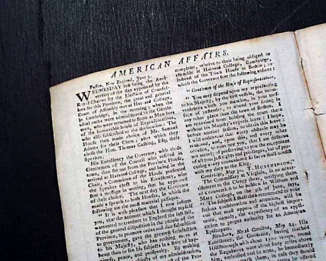
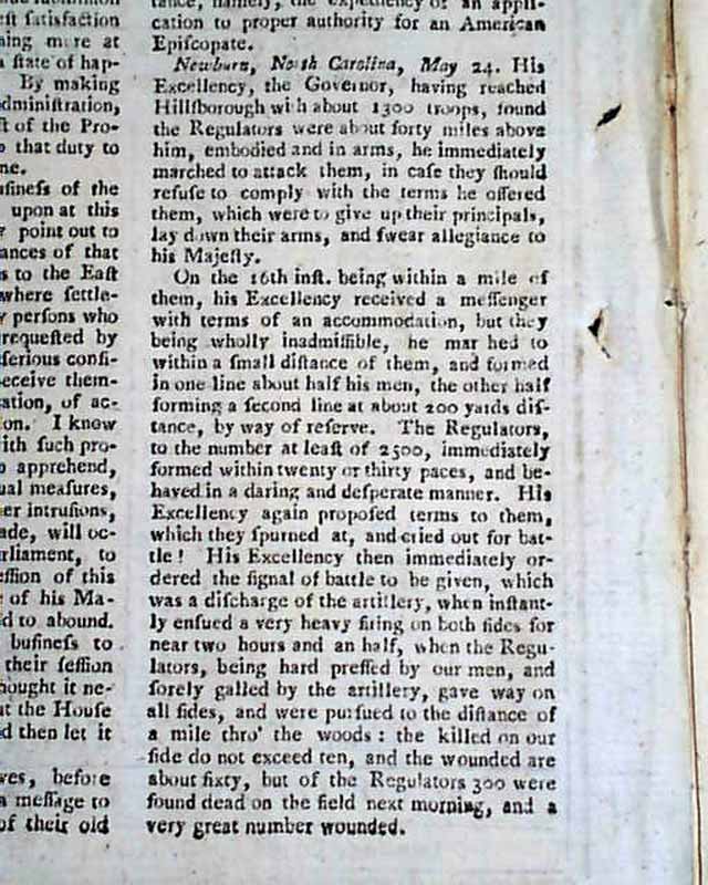
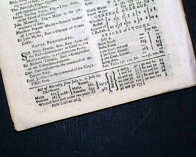
The Gentleman's Magazine, London, July, 1771 The key content in this issue is a page 2 report on what most historians describe as the 1st shedding of blood of the war for American Independence & Freedom. A report from Newburn, North Carolina, states in part, "His Excellency, the Governor, having reached Hillsborough with about 1,300 troops, found the Regulators were about 40 miles above him, embodied and in arms, he immediately marched to attack...". It continues, "...his Excellency received a messenger with terms... but they being wholly inadmissible, he marched..." Additional text includes details of the ensuing battle, including the death count (see images). This was later to become known as the Battle of Alamance.
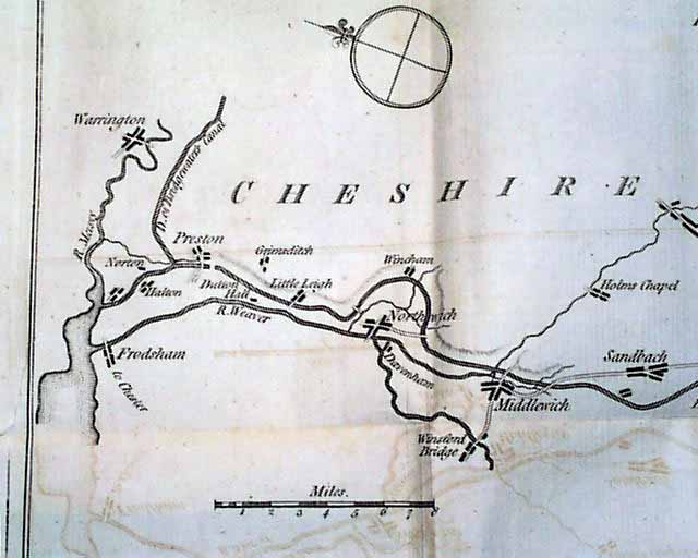
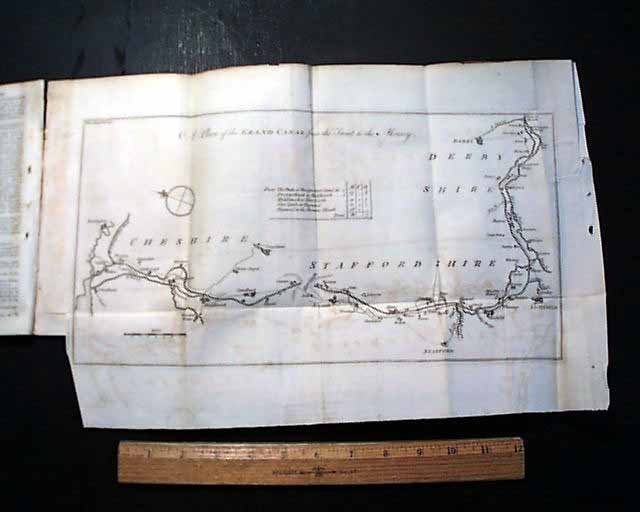
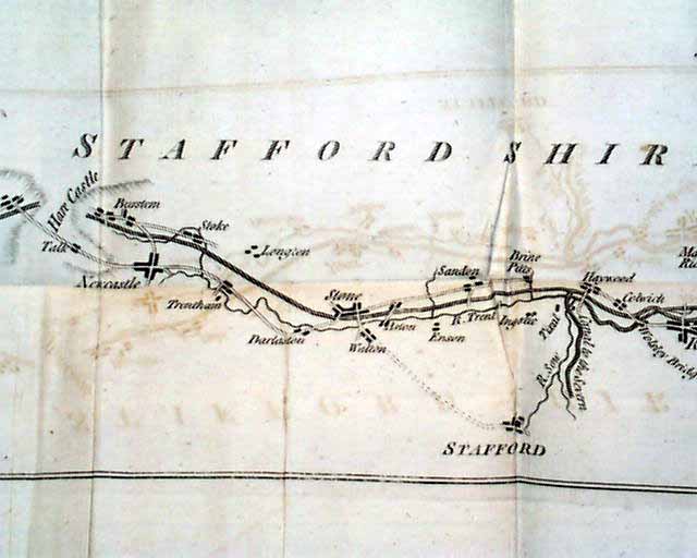
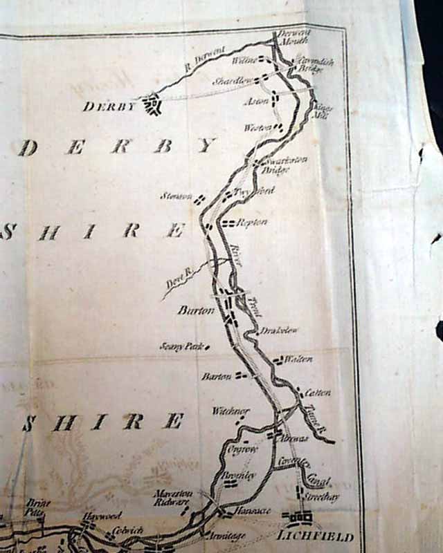
This issue also includes a nice map titled: "A Plan of the Grand Canal from the Trent to the Mersey" rivers in England, with some of the principal towns along the way being Lichfield, Burton, Derby, Rudgley, Stone, Newcastle, Middlewich, Northwich, Frodsham, and Warrington. Many more towns shown on the map as well. The map measures about 10 1/2 by 15 inches including borders, is dated in the upper left: "Gent. Mag. July 1771". Folded several times, some ink offsetting from being folded against itself for 200+ years, a small piece missing at the right margin affects the border only. An early & displayable map.
This issue also includes a nice map titled: "A Plan of the Grand Canal from the Trent to the Mersey" rivers in England, with some of the principal towns along the way being Lichfield, Burton, Derby, Rudgley, Stone, Newcastle, Middlewich, Northwich, Frodsham, and Warrington. Many more towns shown on the map as well. The map measures about 10 1/2 by 15 inches including borders, is dated in the upper left: "Gent. Mag. July 1771". Folded several times, some ink offsetting from being folded against itself for 200+ years, a small piece missing at the right margin affects the border only. An early & displayable map.
Category: The 1600's and 1700's
